Salt Creek Grade Control at Pioneers Blvd
Urban Streams & Channels - Project
Project Description
Salt Creek Grade Control at Pioneers Blvd
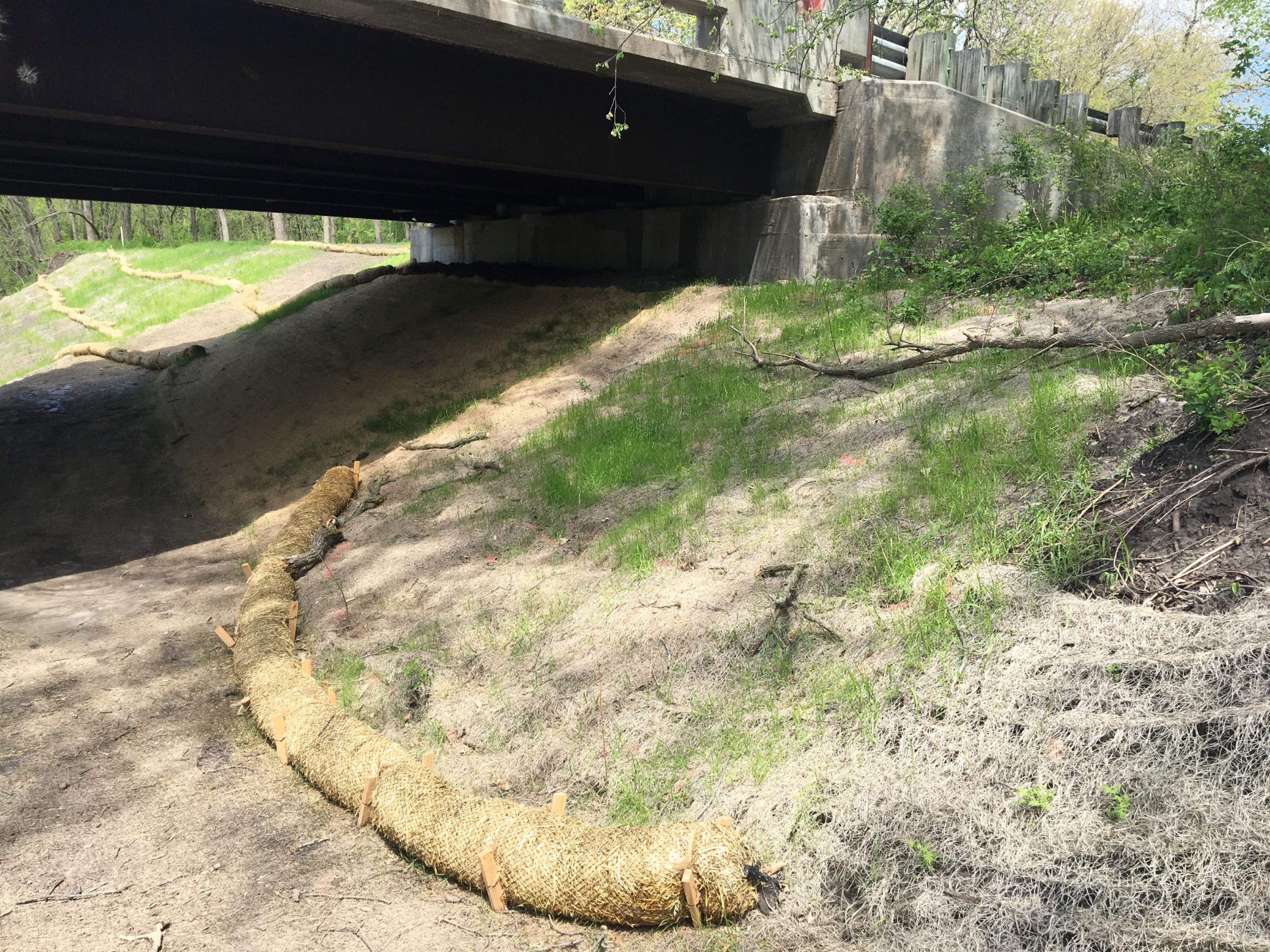
| This project illustrates I&L’s experience designing channel erosion control. The Lower Platte South Natural Resources District (LPSNRD) retained Intuition & Logic to provide channel stability design to address scour and incision threatening the Pioneers Road Bridge. Channel incision and widening along Salt Creek had produced widespread bank failures and exposed the east bridge abutment piles. |
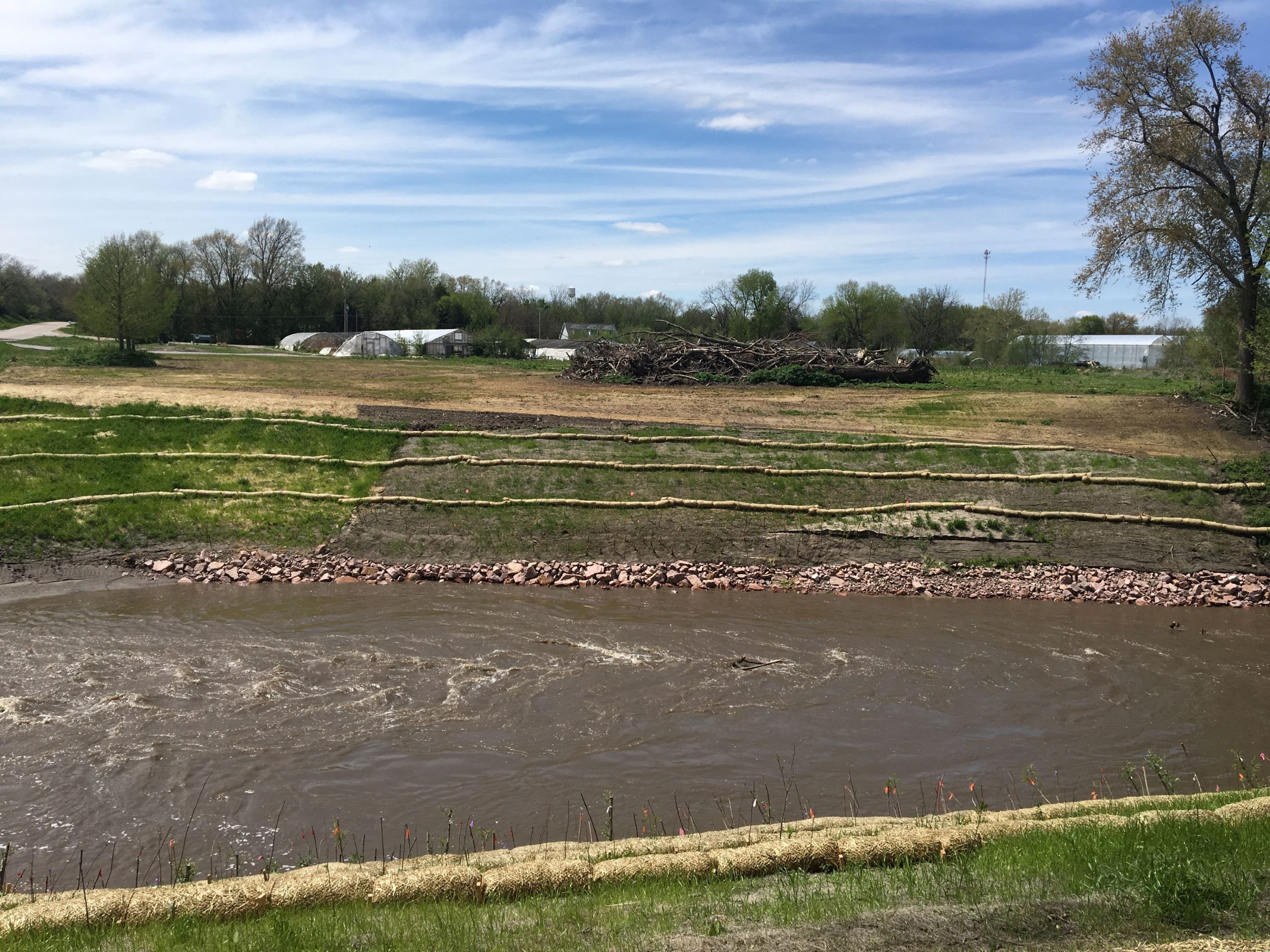
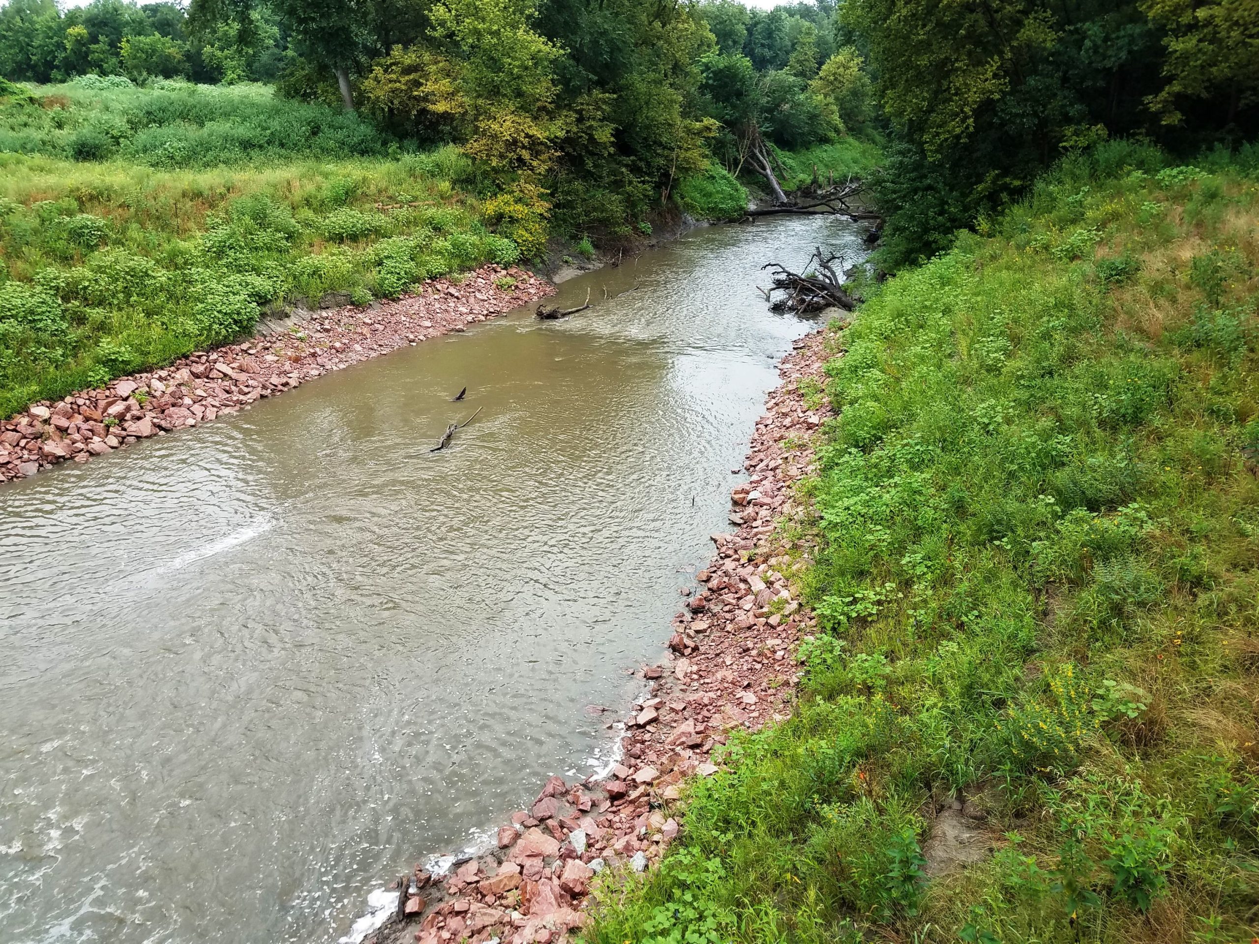
| The Salt Creek grade control design includes a rock grade control immediately downstream of the bridge, stilling basing downstream of the grade control, rock lined slope under the bridge, rock toe protection and regraded and vegetated slope protection upstream and downstream. The project protects the bridge and banks from future erosion and stops channel incision at this location. |
| Project is located in Wilderness Park and the final planting plan was coordinated with the Parks Department and Friends of Wilderness Park, an active local nature advocacy group. |
| 404 permit services include wetland determination and assessment using the Nebraska Stream Assessment and Mitigation Procedures (NeSCAP). Geomorphic field data collection was collected in GIS using a Trimble Yuma hand held device with ESRI ArcMap. Hydraulic modeling was performed using HEC-RAS and used to evaluate bed and bank shear for sediment transport and rock sizing and to support FEMA no-rise certifications. Intuition & Logic provided on site construction support services to the LPSNRD. |
Project Details
Key Personnel:
- Mark Meyer, PE, CFM
- Tim Dean, PE, LEED AP, CFM
Project Features:
- Final Engineering Design
- Plans Specs and Costs
- Preparation of 404 and 401 Permits
- Construction Services
- Spatial data analysis using geographic information systems (GIS)
- Hydrology and Hydraulics Modeling HEC-RAS
- Hydraulic analyses and design activities
Year:
- Design: 2013-2014
- Construction: 2018-2019