Riverside Landing Park Design
Construction Services - Project
Project Description
Riverside Landing Park Design
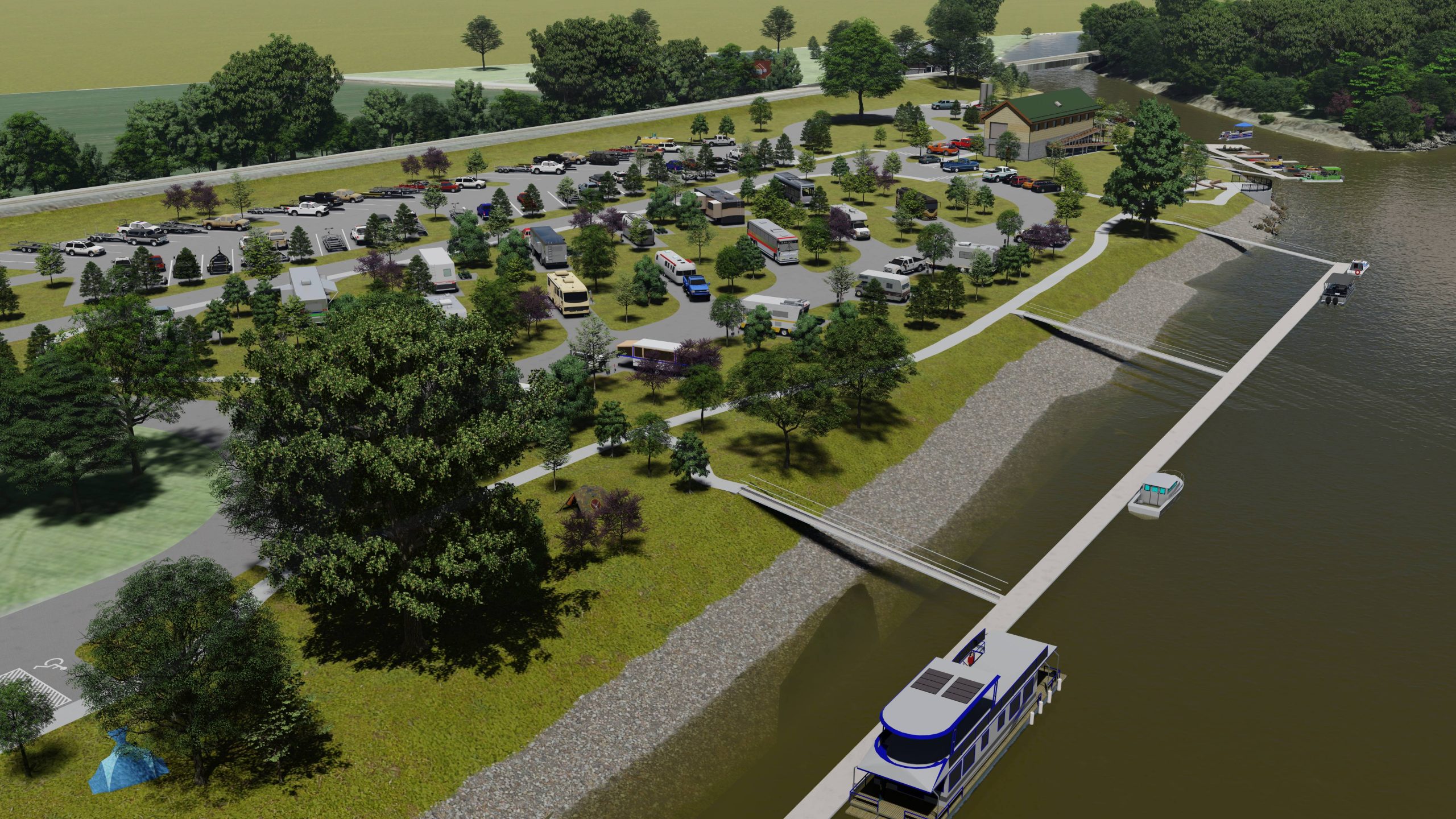
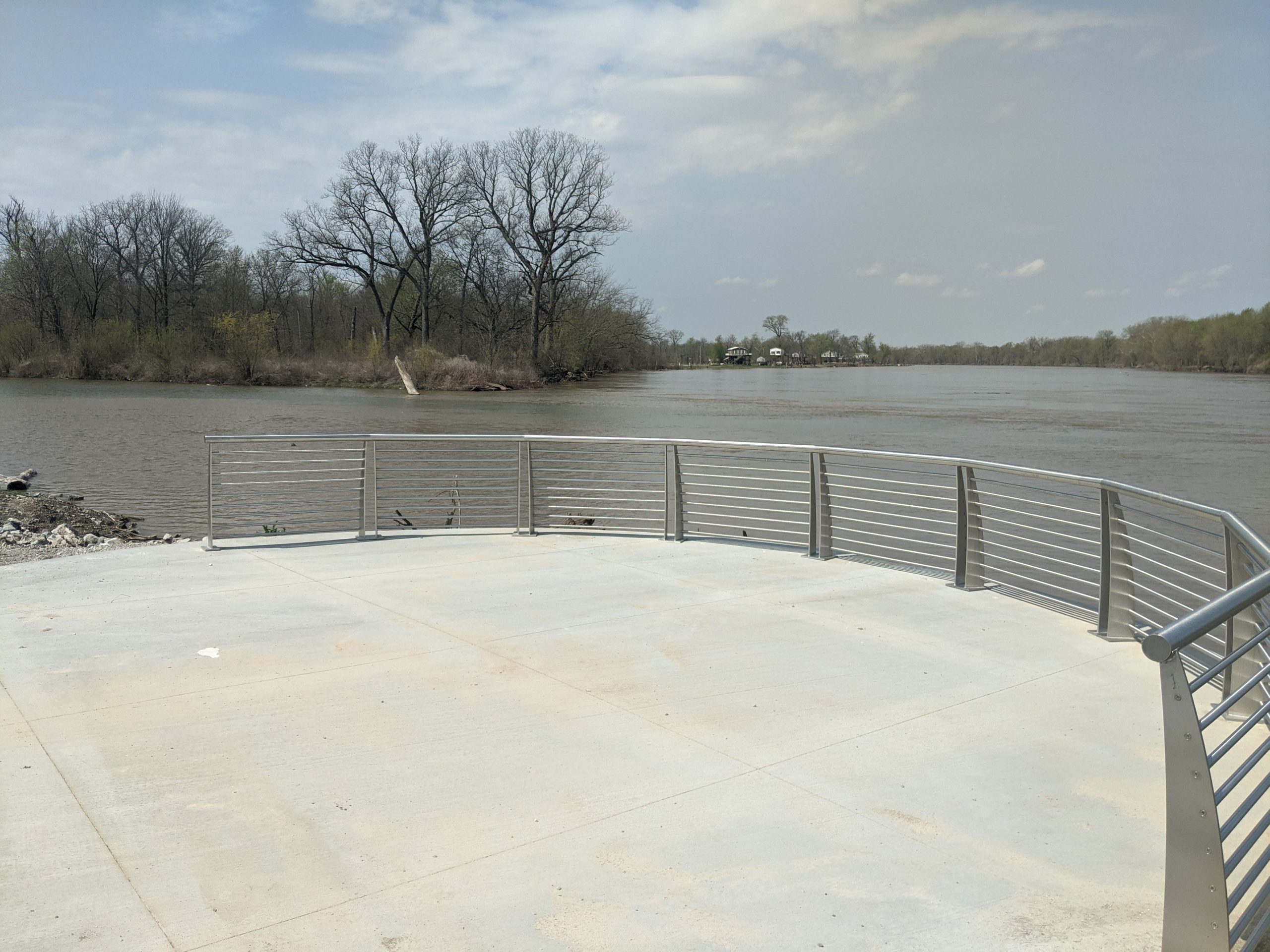
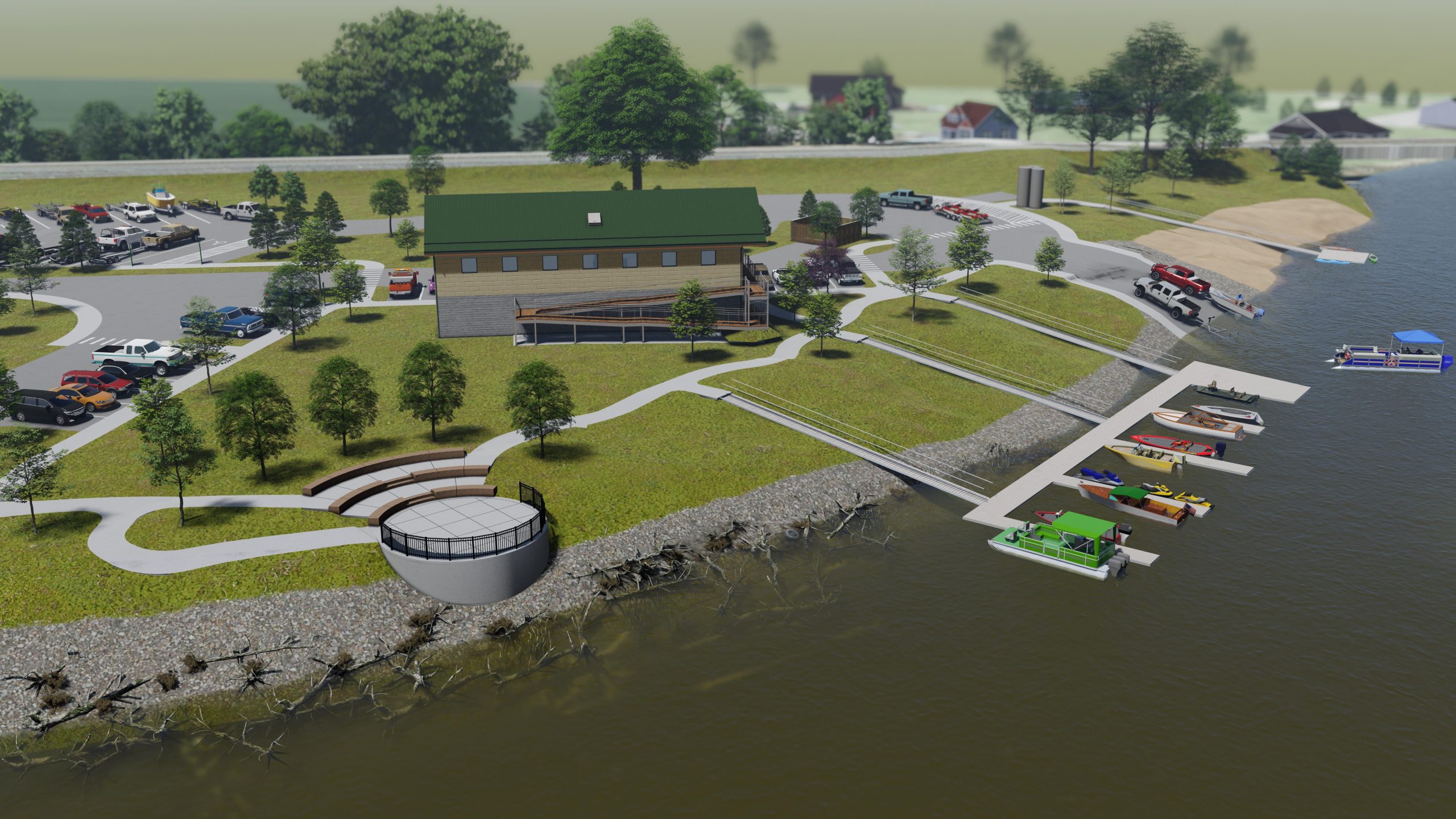
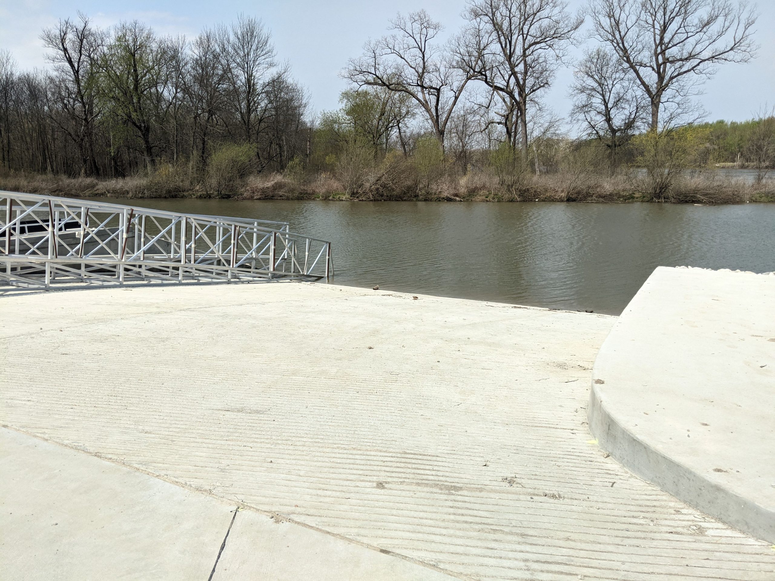
| Riverside Landing Park provides a one-of-a-kind Mississippi River Experience for boaters, RV campers, bicyclers, hikers, kayakers, fishing, and more. The park features a dual boat lanch with ADA accessible loading platform, courtesy boat docks, 18 RV campsites, fire pits, tent camping, fishing, geogrid reinforced gravel beach kayak launch with an ADA accessible dock, circulation trail, council ring with river overlook, well house, and much more. The council ring provides a stunning 180 degree view of the river and is sure to be a favorite desination for decades to come. |
| St Charles County Parks Department retained Intuition & Logic to design Riverside Landing Park, its newest facility at the confluence of Dardenne Creek and the Mississippi River. Intuition & Logic was the leading firm providing planning and civil engineering and the team included Introba for architecture, electric, and plumbing and SWT Design for park planning and landscape architecture. Services included alternatives analysis, a regional trail network master plan, preliminary design plans and cost, permitting, utility coordination, Right-Of-Way plans, Easement documents and legal descriptions, Pre-Final Plans, Specifications, & Estimates (PS&E), Final PS&E, Approved Documents, and Construction Services for the park. |
| Destination River Access |
| Riverside Landing Park is the destination for boaters, kayakers, and river enthusiasts. We designed a dual lane boat launch and 59 boat trailer parking spaces to support the only free boat launch on this section of the Mississippi River. The boat launch has a make ready area and also has an ADA accessible loading platform. Paddlers are also welcome at the geocell reinforced gravel beach located upstream of the boat launch. This is the endpoint for the Dardenne Creek Blueway Trail and also serves to provide paddler access out onto the Mississippi River. There is a separate ADA accessible dock at the beach for loading and launching paddle crafts. The County also has a rental pad nearby for day use kayak rentals. The bank along the entire park was stabilized using a combination of rock armor and biostabilization techniques. The bank stabilization design included fishing access points between the rock armor as well as from any of the docks. |
| In addition to the Kayak Beach dock, two seaparate boat docks were designed for the park. The first is a 9 berth courtesy dock adjacent to the boat launch and the second is a 12 berth day use dock parallel to the Mississippi River. A debris deflector provides protection for these facilities. The docks were designed to ride out any flood events in place and the gangways include a special lift off hinge design to accommodate the 24 ft of bounce in the river elevations. The boat docks will be added at a future phase of the project. |
| Camping enthusiasts are welcome also! The park has 18 RV campsites with utility hookups as well as 7 primitive campsites with direct river views. A RV dump station is located near the park exit and collects into an underground passive storage tank. Walking trails intersperse throughout the park and end at the Council Ring River Overlook providing an unparallelled view up and down the river. |
Project Details
Key Personnel:
- Tim Dean, PE, LEED AP, CFM
- Matt Auld, PE, ENV SP
- Mark Meyer, PE, CFM
Project Features:
- Park Design
- Trail Master planning
- Roadway Design
- Riverbank Stabilization
- Docks
- Boat Launch
- Utilities
- Sanitary Sewer
- Pump Station
- Well House
- Water Main
- Grading
- Paving
- Permitting
- Easements and ROW Documents
- Final Plans, Specifications
- Construction Cost Estimate
- Bidding Services
- Construction Observation
- Change Order
- Shop Drawing/RFI Review
Year:
- Design 2018-2020
- Construction 2021-2022
Designed with Flooding in Mind
One of the big challenges facing the design team was how to deal with the flooding at the confluence of these two large waterways. During the regulatory flood event, the park will be under 10+ feet of water, potentially for weeks at a time.
Riverside Landing Park is designed to handle this flood inundation. All park elements are made from materials that can withstand the innundation or be quickly disconnected and removed from the park ahead of a flood event. All of the pavements in the park are concrete for ease of powerwashing after a flood event. The concrete is also better resistant to uplift from the high groundwater table. All electrical equipment is located on elevated platforms and the wellhouse is also elevated above the 1% annual chance of exceedance flood elevation. The RV utility pedestals are HyPower PowerPorts. These consist of a quick disconnect top that contains all of the electrical components for easy snap off disconnects before a flood and easy re-connection after. The passive sanitary storage tank is designed to resist an uplift pressure from 15 ft of flood innundation. In addition, special design consideration was undertaken for all of the parks’ Grading and Paving. A no net fill requirement was adhered to for all of the site grading and pavement design to ensure that the park would not result in an encroachment into the floodway.
The design team also prepared a flood shutdown manual for County staff to use in preparation for a flood. The manual lists flood procedures tied to upstream and downstream river gages to give County personnel the maximum preparation time ahead of a flood event.
Paving and Utilities
I&L performed the horizontal, vertical, and pavement section design for 12,000 ft of concrete roadways, dual lane boat launch ramp, and a round about!
A 15 ft x 15 ft elevated well house was designed to provide a 120 GPM non-potable service well and pressurization tank to supply 3 yard hydrants and the RV dump station. A bid alternative was designed for a 2,200 sf, two story comfort station that provided 8 restroom stalls, 4 sinks, well head, and water treatment system to support a transient public well facility. The lower level was designed as a parks equipment storage facility.
The sanitary sewer system included alternatives analysis for multiple system configurations and locations. The final design included 2,800-ft of low head force main with lift stations and wet wells to an offsite infiltration field plus a bid alternative design for an onsite gravity system with one 30,000 gallon storage tank with aeration, mixers, wet wells and pumping.
Bidding and Construction
I&L provided bidding and construction services in support of the project construction. Bidding services included bid addendums, bid review and recommendation. Construction services included Request For Information review and responses, Shop Drawings, Change Orders, and construction observations.
Regional Trail Network Master Plan
As part of the Riverside Park design, Intuition & Logic performed a trail connectivity study. The study included 32 segments and over 22 miles of alignment alternatives and strip maps with right-of-way exhibits for the recommended alignment.
The new Riverside Park Greenway Trail Master Plan evaluated connections south to New Town (Boschert Greenway), Lakeside 370 Park (Dardenne Greenway), Fountain Lakes Park, Katy Trail and more. The Connectivity Study included:
- Over 22 miles of trail
- 13 Potential Bridges
- 20 road crossings, 3 signalized
- 30 driveway crossings
- 26 drainage culverts
- 1000 ft of boardwalk
- 15 potential trailhead locations
- Total Easement quantities (square feet) by parcel for all alignment alternatives
Cost estimates for the recommended alignments were developed based on quantities from the strip maps and unit costs from local and regional construction cost databases.


